iMAR Navigation GmbH
Booth number: 6113N-12
www.imar-navigation.de
About us
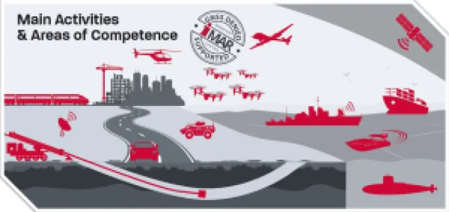
iMAR Navigation GmbH has been a leading developer and manufacturer of high‑precision navigation and positioning systems for more than three decades. Headquartered in Germany, iMAR delivers solutions worldwide for geodesy, exploration, mining, autonomous mobility, and defense.
Our systems are built on cutting‑edge inertial sensor technology, GNSS, and advanced sensor fusion, providing reliable position and attitude data even under extreme conditions. iMAR stands for Made in Germany – precision, robustness, and innovation.
Show Highlights: iCORUS‑02 & iANARO
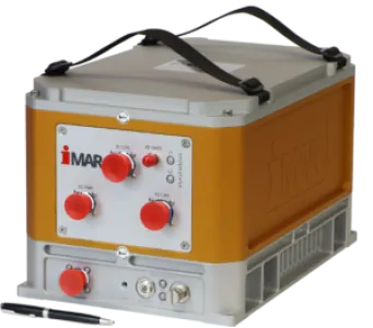
iCORUS‑02 Airborne Strapdown Gravimeter
The iCORUS‑02 is an airborne strapdown gravimeter designed for high‑precision geophysical measurements from the air.
Measures gravity anomalies with exceptional accuracy to support exploration and geological mapping.
Strapdown technology enables operation without complex mechanical stabilization.
Ideal for aircraft‑, UAV‑, and ship‑based surveys in mineral exploration, geodesy, and earth observation.
Rugged, easily integrable system for demanding environments and long‑duration missions.
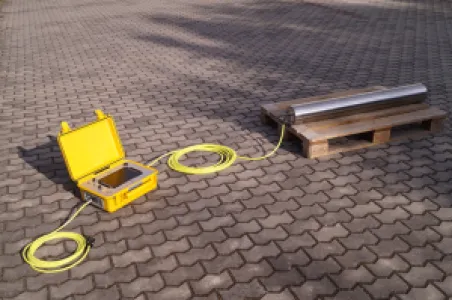
iANARO HDD drill head navigation
The iANARO is a gyro‑based navigation system specifically developed for HDD (Horizontal Directional Drilling) applications.
Provides highly accurate position and attitude data during drilling operations.
Operates independently of GNSS signals, ensuring reliable navigation even underground.
Supports continuous bore path monitoring and integrates seamlessly with existing HDD control systems.
Industrial‑grade design for use in challenging environments.
Benefits for the Mining and Exploration Industry
Efficiency: Precise navigation reduces time and cost in exploration and drilling.
Safety: Reliable positioning even in obstructed or underground environments.
Data Integration: Seamless compatibility with existing GIS and mapping systems.
Future‑Readiness: Designed for deployment in autonomous vehicles and smart mining applications.
Address
Im Reihersbruch 3
66386 St. Ingbert
Germany
E-mail: sales@imar-navigation.de
Phone: +49 6894 96570
Internet: www.imar-navigation.de
Contact person:
Dr. Alexander Loewer
Head of Gravimetry Dept.
E-mail: a.loewer@imar-navigation.de
Products & Services
Show Highlights: iCORUS‑02 Airborne Gravimeter & iANARO HDD Navigation
iCORUS-02 Airborne Strapdown Gravimeter
CORUS‑02 – Precision in Gravimetry and Navigation
The iCORUS‑02 is a next‑generation strapdown gravimeter and navigation system. Equipped with ring laser gyros and high‑accuracy accelerometers, it delivers reliable data for airborne and shipborne gravimetry, navigation, and stabilization. With built‑in data storage and real‑time output of position, velocity, and attitude, it is the ideal solution for geophysical surveys and demanding navigation tasks.
iPosCAL‑GRAV – Smart Processing for Gravimetry Campaigns
iPosCAL‑GRAV is iMAR Navigation’s powerful post‑processing software. It transforms raw INS/GNSS data from systems like the iCORUS‑02 into precise gravimetry results. Automated workflows, cross‑over analysis, and gravity map generation make it fast and efficient to process large‑scale survey campaigns – in the air or at sea.
iANARO - HDD
The iANARO family from iMAR Navigation consists of high‑precision, gyro‑based navigation systems specifically designed for Horizontal Directional Drilling (HDD). These systems deliver reliable position and attitude informatio – a decisive advantage for underground drilling and complex infrastructure projects.
iANARO – Core System
Technology: Gyro‑based navigation system with True‑North heading and pitch measurement.
Application: Precise steering and localization of the drill head in HDD projects.
Functions:
Continuous bore path monitoring.
Operates independently of GNSS – ideal for underground environments.
Rugged, industrial‑grade design for demanding field conditions.
Benefits: Enhances accuracy, safety, and efficiency in directional drilling operations.
iANARO Web‑Control
iANARO Web‑Control is the user‑friendly interface of the iANARO family.
Web‑based: Accessible via standard browsers without additional software installation.
Visualization: Real‑time display of heading, pitch, and bore path.
Integration: Seamlessly connects with existing HDD control systems.
Remote Access: Enables monitoring and control from connected devices.
Advantage: Simplifies operation for engineers and increases transparency throughout the project workflow.
Benefits for the HDD Industry
Efficiency: Precise navigation reduces time and cost in drilling projects.
Safety: Reliable positioning even in complex underground environments.
Flexibility: Scalable for different drilling projects and machine sizes.
Future‑Readiness: Web‑based control supports modern, connected workflows.