Geotomographie GmbH
Booth number: 6108N-1
www.geotomographie.de
About us
Geotomographie GmbH is a German geophysical company specialized in the development and production of high-performance borehole seismic sources and receivers for generating and recording P- and S-waves. The systems are designed for demanding operating conditions down to 1000 meters depth and are used worldwide in geotechnical engineering, exploration, monitoring, and research projects.
The company provides complete downhole and crosswell seismic services from a single source – from robust hardware and field data acquisition to data processing, interpretation, and reporting. With in-house workshop, electronics production, and software development, customized systems can be implemented quickly and flexibly. Geotomographie has many years of experience in industrial applications as well as in national and international research projects.
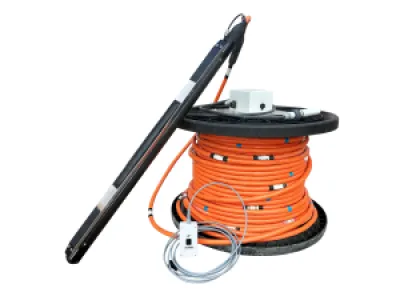
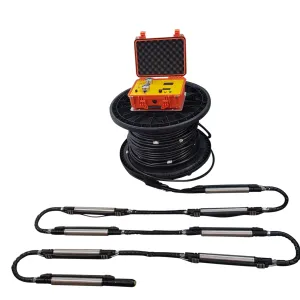
The Multistation Borehole Acquisition System (MBAS) can be used for S-wave borehole tomography or downhole surveying. It consists of up to eight (analog system) or ten (digital system) geophone stations each equipped with a tri-axial sensor. The string is fully water proof and can be used to receive P- and S-waves in dry or water filled boreholes.
Address
Am Tonnenberg 18
56567 Neuwied
Germany
E-mail: info@geotomographie.de
Phone: +49 2631 778135
Internet: www.geotomographie.de
Contact person:
Products & Services
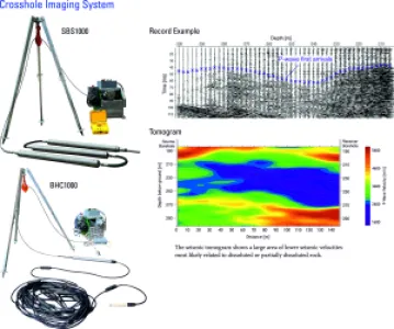
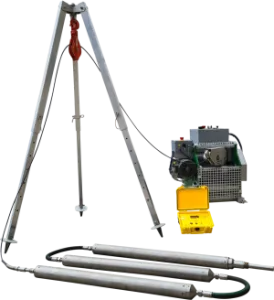
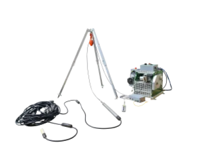
High-resolution crosshole imaging system
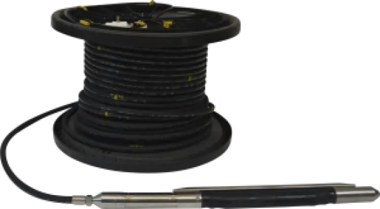
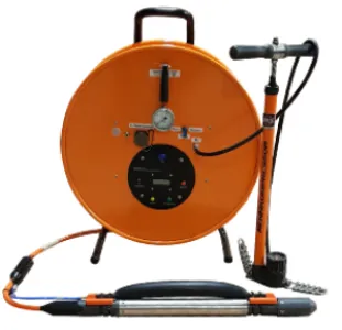
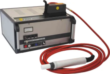
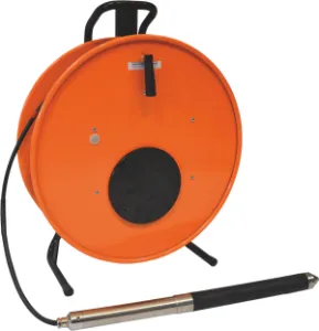
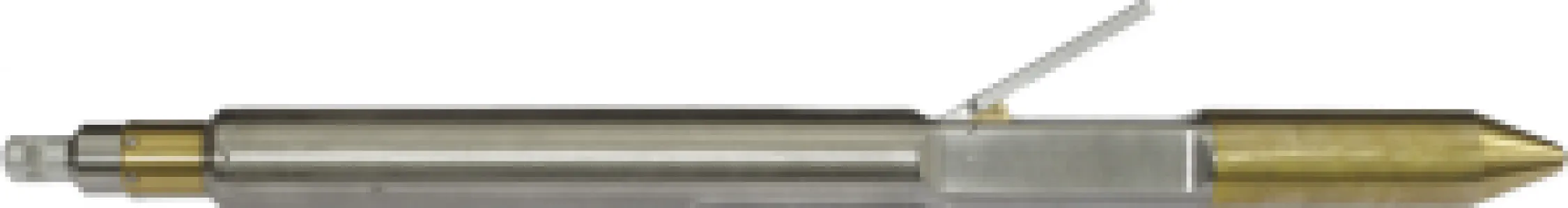
The seismic high-resolution crosshole imaging system consists of the borehole sparker source SBS1000 generating P-waves and the digital hydrophone string BHC1000 as receiver. The system can be used for tomography surveys up to 1000 m depth. High-resolution P-wave tomographic investigations between boreholes is essential for preliminary investigations for large constructions projects, for mining explorations, for nuclear end storage investigations, CO2 monitoring and geothermal projects. The high voltage capacitors (charging up to 3200 V) inside the SBS1000 probe allows the release of high frequent Pwaves with an excellent signal repeatability and a wide frequency range up to several kilohertz. The power supply is ensured by the surface control unit which is connected by a standard 4-conductor logging cable to the SBSB1000 probe by a GO-4 cable head at the top and sends out a TTL time break trigger. The hydrophone string is fully digitized and consists of a downhole digitization unit which communicates with the BHC1000 surface unit and 24 hydrophones moulded to a multicore cable. The tool can be connected directly to the laptop. Using the associated acquisition software data can be visualized and stored. No further seismograph is needed.The 3D imaging software GeoTomCG is a tomographic inversion program for traveltime and amplitude data sets and completes the system.